
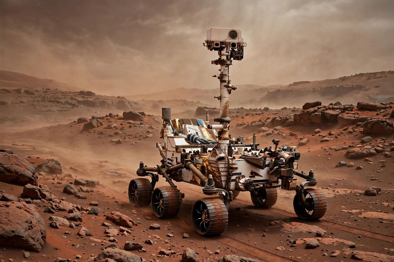
There is no GPS on Mars. No satellites whispering position fixes, no cell towers, no magnetic field reliable enough for a compass. Yet NASA’s rovers — Sojourner, Spirit, Opportunity, Curiosity, and now Perseverance — have driven a combined distance of dozens of miles across alien terrain, threading between rocks and skirting cliffs with no driver on board. Radio signals take between 4 and 24 minutes to cross the gulf between Earth and Mars, so joystick driving is physically impossible. The rovers must navigate themselves.
How do JPL rovers navigate on Mars? The answer is a layered system of cameras, inertial sensors, and increasingly sophisticated autonomy — built up over three decades at NASA’s Jet Propulsion Laboratory. Here is how robots find their way on a world with no maps in the terrestrial sense and no one to ask for directions.
Dead Reckoning: The Foundation
Every rover starts with the basics: knowing how far its wheels have turned. Wheel odometry counts rotations to estimate distance traveled, while an inertial measurement unit (IMU) — gyroscopes and accelerometers — tracks orientation and tilt. Together they provide dead reckoning: a running estimate of position relative to the starting point.
But Mars conspires against dead reckoning. Wheels slip in soft sand — sometimes spinning freely while the rover goes nowhere — and every slip injects error. Over a long drive, these small errors compound into serious position uncertainty. Engineers at JPL learned this the hard way when early rovers’ position estimates drifted. Dead reckoning is necessary, but on Mars it is never sufficient. It is the rough draft of navigation, constantly corrected by smarter systems.
Seeing the Terrain: Stereo Cameras Everywhere
Rovers are studded with cameras that serve as eyes. Navigation cameras (navcams) on the mast capture stereo pairs — two slightly offset views that software fuses into 3D range maps of the surrounding terrain. Hazard avoidance cameras (hazcams) mounted low on the chassis watch for immediate obstacles. On Perseverance, a total of 23 cameras contribute to the navigation picture.
Before each drive segment, the rover builds a local terrain map from these stereo images, classifying every patch of ground as traversable or hazardous based on slope, roughness, and rock height. This geometric hazard detection runs onboard, in real time, with no help from Earth. The Mars exploration program’s public archives contain thousands of these raw navigation images — ghostly stereo landscapes that rover drivers studied daily.
Visual Odometry: Tracking the World Going By
JPL’s breakthrough navigation technique is visual odometry — essentially, the rover watches the ground slide past and calculates its motion from the visual flow. The software picks out distinctive features (rock corners, texture patches) in one image, finds the same features in the next image, and triangulates how far and in which direction the rover moved.
Visual odometry corrects the wheel-slip errors that plague dead reckoning, because it measures actual motion over ground rather than wheel rotation. It was first proven on the Mars Exploration Rovers and has been refined ever since. The technique struggles on featureless terrain — smooth sand dunes with no distinguishing marks can blind it — so the software constantly evaluates its own confidence and falls back to other sensors when visual tracking degrades. It is a humble, self-aware algorithm: it knows when it cannot see.
Autonomous Navigation: AutoNav
The real magic is AutoNav, the onboard path-planning system. Given a target direction from Earth, AutoNav evaluates a fan of candidate arcs — possible short driving paths — against the stereo terrain map, scoring each for safety and progress toward the goal. It picks the best arc, drives it, re-images, and repeats. The rover literally chooses its own route around obstacles, meters at a time, with nobody watching.
Each rover generation has pushed autonomy further. Spirit and Opportunity used AutoNav cautiously for portions of drives. Curiosity’s upgraded system drives longer autonomous stretches. Perseverance, with its faster processors, navigates far more aggressively — covering in a single autonomous drive what took Curiosity a week. Faster autonomy means more science per sol, because driving time is science time lost.
How Rover Drivers Still Steer the Mission
Autonomy does not mean humans are out of the loop. Each Martian morning, a team of rover drivers at JPL reviews downlinked images, plots the sol’s drive on detailed maps, and uploads a sequence of waypoints — strategic decisions like “head for that ridge, avoid the dune field.” The rover executes tactically; humans command strategically. It is a partnership across up to 250 million miles, and the drivers’ terrain-reading skill — honed on NASA’s testbeds in California deserts — remains irreplaceable.
Landing Precision: Terrain-Relative Navigation
Navigation begins before the wheels even touch down. Perseverance’s landing used Terrain-Relative Navigation: during descent, a camera photographed the ground rushing past, matched it against an onboard map of hazards, and diverted the spacecraft away from danger to a safe spot in Jezero Crater. Previous missions landed blind within a large ellipse and hoped; Perseverance steered. Future missions will push this further, aiming for pinpoint landings beside scientifically precious targets.
What Comes Next: Helicopter Scouts and Smarter Rovers
The Ingenuity helicopter — originally a technology demo — became an aerial scout, flying ahead of Perseverance to photograph terrain and identify safe routes and interesting targets. Its 72 flights proved that Mars’ thin atmosphere can support powered flight and previewed a future where every rover has an airborne partner. The planned Mars Sample Return campaign and eventual human missions will demand rovers that navigate faster, farther, and with less Earth supervision — perhaps using orbital maps for global localization the way self-driving cars use HD maps. The same autonomy lineage that started with counting wheel rotations is heading, step by step, toward robots that explore Mars the way field geologists explore Earth: with judgment.
Conclusion
JPL rovers navigate Mars through a layered system: wheel and inertial dead reckoning for the rough estimate, stereo cameras for 3D terrain maps, visual odometry to correct wheel slip by watching the ground move, and AutoNav to pick safe paths autonomously — all under strategic direction from human drivers on Earth. With no GPS and up to 24-minute communication delays, self-reliance is not a feature. It is the entire design philosophy.
Further reading: For more on this topic, see upgrading the RAM in an older laptop yourself and whether you still need antivirus software.
Frequently Asked Questions
Why can’t NASA just drive Mars rovers with a joystick?
Radio signals take 4 to 24 minutes each way between Earth and Mars. By the time a driver saw an obstacle and reacted, the rover would have been driving blind for up to 48 minutes round-trip. Real-time control is physically impossible, so rovers must navigate autonomously.
What is visual odometry?
A navigation technique where the rover tracks distinctive ground features across successive camera images to measure its actual motion. It corrects for wheel slip in sand, which makes wheel-rotation counting unreliable on Mars.
How do rovers avoid driving off cliffs?
Stereo cameras build 3D maps of surrounding terrain, software classifies slopes and rocks as hazards, and the AutoNav system evaluates candidate driving arcs — rejecting any path that risks the rover. Tilt sensors provide a final safety check during motion.
Do humans still control the rovers?
Yes, strategically. Rover drivers at JPL plan each day’s route using downlinked images and upload waypoint sequences. The rover handles tactical execution — steering around obstacles autonomously — while humans make the big navigation decisions.